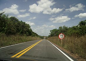
BR-401 (Brazil)
Jump to navigation
Jump to search
 | ||||
 | ||||
| Route information | ||||
| Length | 202.9 km (126.1 mi) | |||
| Major junctions | ||||
| South end | Boa Vista, Roraima | |||
| North end | Normandia, Roraima | |||
| Location | ||||
| Country | Brazil | |||
| Highway system | ||||
| ||||
BR-401 is a federal highway in the state of Roraima in Brazil. The 202.9 km (126.1 mi) road[1] connects Boa Vista with Normandia and the road network of Guyana.[2][3]
The Ponte dos Macuxis over the Branco River was completed on 29 August 1975.[4] The Takutu River Bridge was completed in 2009, and provides access to the road network of Guyana.[5] The bridge switches between left- and right-hand drive automatically.[6]
In 2018, the section between Boa Vista and the border with Guyana was fully paved.[2] As of 2020, a section of almost 80 kilometres between Bonfim and Normandia is still unpaved.[3]
References
- ^ a b "BR-401" (PDF) (in Portuguese). Ministry of Transport. Archived from the original (PDF) on 12 December 2018. Retrieved 9 April 2021.
- ^ a b "BR-401, em Roraima, ganha mais um trecho restaurado e qualificado" (in Portuguese). Ministry of Transport Brazil. Retrieved 9 April 2021.
- ^ a b "Produtores reclamam das condições de trecho da BR-401". Boa Vistaja (in Portuguese). Retrieved 9 April 2021.
- ^ "Ponte dos Macuxis em Boa Vista". Viaja Brasil (in Portuguese). Retrieved 9 April 2021.
- ^ "Takutu Bridge to open Friday". Kaieteur News Online. Retrieved 9 April 2021.
- ^ "Takutu River Bridge – Guyana's Border – Brazil". Guyana South America. Retrieved 9 April 2021.
External links
Media related to BR-401 (Brazil) at Wikimedia Commons