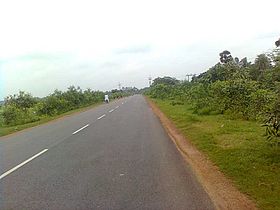
State Highway 4 (West Bengal)
| Route information | |
|---|---|
| Length | 466 km (290 mi) |
| Major junctions | |
| From | SH 4A at Jhalda |
| |
| To | SH 57 (Odisha) at Digha |
| Location | |
| Country | India |
| State | West Bengal |
| Districts | Purulia, Bankura, Paschim Medinipur, Purba Medinipur |
| Highway system | |
| State Highways in West Bengal | |
State Highway 4 (SH 4) is a state highway in West Bengal, India.
Route
SH 4 originates from Jhalda at the junction with SH 4A and passes through Baghmundi, Balarampur, Barabazar, Barabhum, Sindri, Manbazar, Khatra, Raipur Bazar, Sarenga, Pingboni, Goaltore, Nayabasat, Chandrakona Road, Chandrakona, Khirpai, Ghatal, Daspur, Panskura, Tamluk, Nandakumar, Math Chandipur, Kismat Bajkul, Brajalalchak, Khejuri, Marishda, Daisai, Contai, Bara Bankuya, Ramnagar and terminates at Digha at the crossing with SH 57 (Odisha) near Old Digha Sea Beach.[1]
The total length of SH 4 is 466 kilometers (290 mi).[2]
Districts traversed by SH 4 are:[3]
Purulia district (0 - 115 km)
Bankura district (115 - 195 km)
Paschim Medinipur (195 - 303 km)
Purba Medinipur (303 - 466 km)
Rivers crossed by SH 4 are: Kangsabati, Haldi, Silabati[1]
Road sections
It is divided into different sections as follows:[2][4][5] [6][7]
| Road section | District | CD Block | Length (km) |
|---|---|---|---|
| Jhalda-Baghmundi-Balarampur | Purulia | Jhalda I, Baghmundi, Balarampur | 62 |
| Balarampur-Barabhum-Sidn-Manbazar-Bansa | Purulia | Barabazar, Manbazar I | 53 |
| Bansa-Khatra | Bankura | Hirbandh, Khatra | 18 |
| Khatra-Kanchendaghat | Bankura | 21 | |
| Kachendaghat-Raipur | Bankura | Raipur | 25 |
| Raipur-Simlighat-Sarenga | Bankura | Sarenga | 16 |
| Sarenga-Goaltore-Chandrakona | Paschim Medinipur | Garhbeta II, Garhbeta III, Chandrakona II | 29 |
| Chandrakona-Ghatal | Paschim Medinipur | Chandrakona I, Ghatal | 45 |
| Ghatal-Panskura | Paschim Medinipur | Daspur I | 34 |
| Panskura-Tamluk | Purba Medinipur | Panskura I, Tamluk | 69 |
| Tamluk-Contai-Digha | Purba Medinipur | Nandakumar, Chandipur, Bhagabanpur II, Khejuri I, Contai III, Contai I, Ramnagar II, Ramnagar I | 84 |
| Contai Bypass | Purba Medinipur | 3 | |
| Digha Foreshore | Purba Medinipur | 7 |
See also
External links
Digha travel guide from Wikivoyage
References
- ^ a b Google maps
- ^ a b "List of State Highways". West Bengal Traffic Police. Retrieved 31 August 2016.
- ^ "Road - Highway". Public Works Department, Government of West Bengal. Retrieved 28 September 2016.
- ^ "Puruliya Tehsil/ CD Block Map". Maps of India. Retrieved 15 September 2016.
- ^ "Bankura Tehsil/ CD Block Map". Maps of India. Retrieved 15 September 2016.
- ^ "Paschim Medinipur Tehsil/ CD Block". Maps of India. Retrieved 15 September 2016.
- ^ "Purba Medinipur Tehsil/ CD Block". Maps of India. Retrieved 15 September 2016.

