R483 (Republic of Ireland)
Jump to navigation
Jump to search
| Bóthar R483 (Irish) | |
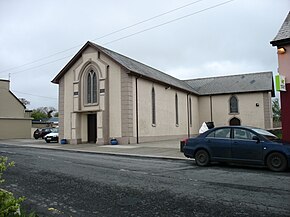
 St Mary's Church, Creegh, on the R483 | |
| Route information | |
| Length | 17.9 km (11.1 mi) |
| Location | |
| Country | Republic of Ireland |
| Primary destinations |
|
| Highway system | |
The R483 is a regional road in Ireland which links the N67 with Kilrush in County Clare.[1] The road passes through a number of villages, including Creegh, and Cooraclare. The road is 17.9 km (11.1 mi) long.
See also
References
- ^ "Department of Transport, Tourism and Sport" (PDF). www.gov.ie. Retrieved 2020-07-22.