Puerto Rico Highway 802
Jump to navigation
Jump to search
Highway 802 | ||||
|---|---|---|---|---|
| Ruta 802 (Spanish) | ||||
| Route information | ||||
| Maintained by Puerto Rico DTPW | ||||
| Length | 6.6 km[1] (4.1 mi) | |||
| Major junctions | ||||
| West end | ||||
| East end | ||||
| Location | ||||
| Country | United States | |||
| Territory | Puerto Rico | |||
| Municipalities | Corozal, Naranjito | |||
| Highway system | ||||
| ||||

Puerto Rico Highway 802 (PR-802) is an east–west road between the municipalities of Corozal and Naranjito in Puerto Rico.[2] With a length of 6.6 kilometers (4.1 mi),[1] it begins at its intersection with PR-801 in Palmarito barrio in Corozal, and ends at its junction with PR-152 and PR-803 in Cedro Arriba barrio in Naranjito.[3]
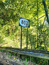
Puerto Rico Highway 802 east in Palmarito, Corozal

Major intersections
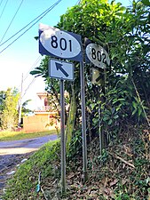
PR-801 east at PR-802 intersection in Palmarito, Corozal
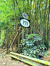
PR-802 east approaching PR-771 intersection in Maná, Corozal
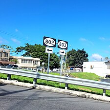
Signs for PR-802 and PR-803 at PR-152 junction in Cedro Arriba, Naranjito

.jpg)
.jpg)
| Municipality | Location | km[1] | mi | Destinations | Notes |
|---|---|---|---|---|---|
| Corozal | Palmarito | 0.0 | 0.0 | Western terminus of PR-802 | |
| Maná | 3.9 | 2.4 | |||
| Naranjito | Cedro Arriba | 6.6 | 4.1 | Eastern terminus of PR-802 | |
| 1.000 mi = 1.609 km; 1.000 km = 0.621 mi | |||||
References
- ^ a b c Google (August 17, 2020). "PR-802" (Map). Google Maps. Google. Retrieved August 17, 2020.
- ^ National Geographic Maps (2011). Puerto Rico (Map). 1:125,000. Adventure Map (Book 3107). Evergreen, Colorado: National Geographic Maps. ISBN 978-1566955188. OCLC 756511572.
- ^ "PR-802, Corozal, Puerto Rico". geoview.info. Retrieved June 1, 2021.
External links
 Media related to Puerto Rico Highway 802 at Wikimedia Commons