Puerto Rico Highway 487
Jump to navigation
Jump to search
Highway 487 | ||||
|---|---|---|---|---|
| Ruta 487 (Spanish) | ||||
| Route information | ||||
| Maintained by Puerto Rico DTPW | ||||
| Length | 8.7 km[1] (5.4 mi) | |||
| Existed | 1953[2]–present | |||
| Major junctions | ||||
| South end | ||||
| North end | ||||
| Location | ||||
| Country | United States | |||
| Territory | Puerto Rico | |||
| Municipalities | Hatillo | |||
| Highway system | ||||
| ||||

Puerto Rico Highway 487 (PR-487) is a north–south road located entirely in the municipality of Hatillo, Puerto Rico.[3] With a length of 8.7 kilometers (5.4 mi),[1] it begins at its intersection with PR-130 and PR-488 on the Naranjito–Buena Vista line,[4] and ends at its junction with PR-129 in Bayaney barrio.[5]
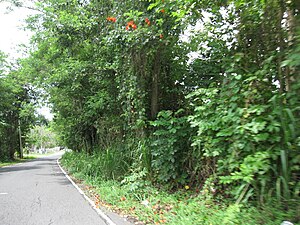
Traveling south to north on PR-487

Traveling south to north on PR-487


Major intersections
The entire route is located in Hatillo.
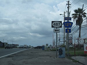
PR-129 junction with PR-487
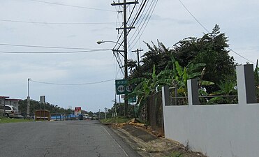
PR-487 near the interchange with PR-130 and PR-488


| Location | km[1] | mi | Destinations | Notes | |
|---|---|---|---|---|---|
| Bayaney | 8.7 | 5.4 | Southern terminus of PR-487 | ||
| Buena Vista–Naranjito line | 0.0 | 0.0 | Northern terminus of PR-487 | ||
| 1.000 mi = 1.609 km; 1.000 km = 0.621 mi | |||||
See also
References
- ^ a b c Google (August 3, 2020). "PR-487" (Map). Google Maps. Google. Retrieved August 3, 2020.
- ^ "Hatillo, Memoria Núm. 63" (PDF). Puerto Rico Planning Board (in Spanish). 1954. Retrieved August 3, 2020.
- ^ National Geographic Maps (2011). Puerto Rico (Map). 1:125,000. Adventure Map (Book 3107). Evergreen, Colorado: National Geographic Maps. ISBN 978-1566955188. OCLC 756511572.
- ^ "PR-487, Hatillo, Puerto Rico". geoview.info. Retrieved August 3, 2020.
- ^ "Tránsito Promedio Diario (AADT)". Transit Data (Datos de Tránsito) (in Spanish). Puerto Rico Department of Transportation and Public Works. p. 113. Archived from the original on April 1, 2019. Retrieved August 3, 2020.
External links
 Media related to Puerto Rico Highway 487 at Wikimedia Commons