New Hampshire Route 87
Map of Rockingham County in southeastern New Hampshire with NH 87 highlighted in red | ||||
| Route information | ||||
| Maintained by NHDOT | ||||
| Length | 6.317 mi[1] (10.166 km) | |||
| Major junctions | ||||
| West end | ||||
| East end | ||||
| Location | ||||
| Country | United States | |||
| State | New Hampshire | |||
| Counties | Rockingham | |||
| Highway system | ||||
| ||||
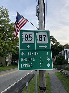
New Hampshire Route 87 is a 6.317-mile-long (10.166 km) east–west highway in Rockingham County in southeastern New Hampshire connecting Newfields to Epping. The eastern terminus of NH 87 is in Newfields at its junction with New Hampshire Route 85. The western terminus is in Epping at its junction with New Hampshire Route 125.
Route description

NH 87 begins in the west at NH 125 in Epping, north of downtown. The highway proceeds eastward out of town and crosses into Newfields. NH 87 continues to the town center of Newfields, where it ends at an intersection with NH 85 near the Squamscott River.
In Newfields, the highway is known locally as Piscassic Road. In Epping, the highway is known locally as Hedding Road.
Junction list
The entire route is in Rockingham County. [1][2]
| Location[1][2] | mi[1][2] | km | Destinations | Notes | |
|---|---|---|---|---|---|
| Epping | 0.000 | 0.000 | Western terminus | ||
| Newfields | 6.317 | 10.166 | Eastern terminus | ||
| 1.000 mi = 1.609 km; 1.000 km = 0.621 mi | |||||
References
- ^ a b c Bureau of Planning & Community Assistance (February 20, 2015). "NH Public Roads". Concord, New Hampshire: New Hampshire Department of Transportation. Retrieved April 7, 2015.
- ^ a b Bureau of Planning & Community Assistance (April 3, 2015). "Nodal Reference 2015, State of New Hampshire". New Hampshire Department of Transportation. Retrieved April 7, 2015.[permanent dead link]