Colorado State Highway 394
Map of Moffat County in northwestern Colorado with SH 394 highlighted in red | ||||
| Route information | ||||
| Maintained by CDOT | ||||
| Length | 9.378 mi[1] (15.092 km) | |||
| Existed | c. 1949–present | |||
| Major junctions | ||||
| West end | ||||
| East end | ||||
| Location | ||||
| Country | United States | |||
| State | Colorado | |||
| Counties | Moffat | |||
| Highway system | ||||
| ||||
| ||||
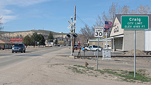
State Highway 394 (SH 394) is a 9.378 mi (15.092 km) state highway in Moffat County, Colorado, United States. SH 394's western terminus is at U.S. Route 40/Colorado State Highway 13 (US 40/SH 13) in Craig, and the eastern terminus is at the Moffat–Routt county line.
Route description


SH 394 begins in Craig at the intersection of Ranney Street and West Victory Way (carrying westbound US 40/SH 13). From its western terminus SH 394 proceeds south on Ranney Street for one block before crossing the eastbound direction of the US 40/SH 13 one-way pair that runs along West 4th Street. About another block south, the highway crosses a set of railroad tracks and leaves the city limits of Craig.
About 0.7 miles (1.1 km) south of Craig, after another railroad crossing, SH 394 crosses over the Yampa River. Roughly 0.3 miles (0.48 km) farther south the highway turns east at an intersection with County Road 107 (CR 107), which continues south, on the southern edge of a small oxbow lake of the Yampa River. East of CR 107, SH heads easterly, roughly parallel US 40.[2]
After heading easterly for about 5.5 miles (8.9 km) and immediately after a junction with County Road 100, SH 394 turns south and (as of September 2008) the pavement ends shortly thereafter. After heading southerly for roughly 1.4 miles (2.3 km), at a T intersection with County Road 113 (which continues south), the highway turns to head easterly for about another 1.1 miles (1.8 km). The highway ends at the county line between Moffat County and Routt County, southeast of Dresher Reservoir. The road continues easterly from SH 294's western terminus as County Road 65 in Routt County to rejoin US 40 in Hayden.[2]
Major intersections
The entire route is in Moffat County.
| Location | mi[1] | km | Destinations[2] | Notes | |
|---|---|---|---|---|---|
| Craig | 0.000 | 0.000 | Ranney Street – north | Continuation north of western terminus | |
| Western terminus; one-way westbound road | |||||
| 0.124 | 0.200 | One-way eastbound road | |||
| | Bridge over the Yampa River | ||||
| 9.378 | 15.092 | Moffat–Routt county line | Eastern terminus | ||
| Continuation east (into Routt County) beyond eastern terminus | |||||
| 1.000 mi = 1.609 km; 1.000 km = 0.621 mi | |||||
See also
References
- ^ a b "Highway Data Explorer, Online Transportation Information System". Colorado Department of Transportation. Archived from the original on 2012-09-10. Retrieved 2019-01-08.
- ^ a b c Google (2023-01-27). "CO-394" (Map). Google Maps. Google. Retrieved 2023-01-27.
External links
Media related to Colorado State Highway 394 at Wikimedia Commons