California State Route 145
SR 145 highlighted in red | ||||
| Route information | ||||
| Maintained by Caltrans | ||||
| Length | 67 mi[1] (108 km) | |||
| Major junctions | ||||
| South end | ||||
| North end | ||||
| Location | ||||
| Country | United States | |||
| State | California | |||
| Counties | Fresno, Madera | |||
| Highway system | ||||
| ||||
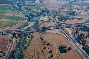
State Route 145 is a state highway in the U.S. state of California, running through the heart of the San Joaquin Valley from Interstate 5 near Coalinga north to Route 41 north of Fresno.
Route description
SR 145 travels through the center of the San Joaquin Valley, remaining a rural two-lane road in its entirety. The southern terminus of SR 145 is at I-5 near Coalinga. SR 145 heads northeast as Fresno-Coalinga Road, turning north at the junction with SR 269 in Five Points, where it assumes the designation as Lassen Avenue. After passing through the town of Helm, SR 145 heads northeast as McMullin Grade, before turning north again as South Madera Avenue. SR 145 intersects with SR 180 in the city of Kerman, where it continues north to cross into Madera County. After passing through Ripperdan, SR 145 intersects SR 99 in Madera. From Madera, the route turns east, and ends at SR 41.[2]
Various crops such as cotton, table grapes, tomatoes and melons are grown along the route in one of the most productive agricultural areas in the world.
SR 145 is part of the California Freeway and Expressway System,[3] and near SR 99 is part of the National Highway System,[4] a network of highways that are considered essential to the country's economy, defense, and mobility by the Federal Highway Administration.[5]
Major intersections
| County | Location | mi [1][6] | km | Destinations | Notes | |
|---|---|---|---|---|---|---|
| Fresno | | 0.00 | 0.00 | Continuation beyond I-5 | ||
| | 0.00 | 0.00 | Interchange; south end of SR 145; I-5 exit 337 | |||
| Five Points | 13.21 | 21.26 | Northern terminus of SR 269 | |||
| Kerman | 35.15 | 56.57 | ||||
| Madera | Madera | 50.23 | 80.84 | Interchange; SR 99 exit 153B | ||
| 50.47 | 81.22 | South end of SR 99 Bus. overlap; former US 99 south | ||||
| 50.83 | 81.80 | Gateway Drive north (SR 99 Bus. north), Yosemite Avenue | North end of SR 99 Bus. overlap; former US 99 north | |||
| | 66.59 | 107.17 | North end of SR 145 | |||
| | 66.59 | 107.17 | Road 145 – Millerton Lake | Continuation beyond SR 41 | ||
1.000 mi = 1.609 km; 1.000 km = 0.621 mi
| ||||||
References
- ^ a b California Department of Transportation (July 2007). "Log of Bridges on State Highways". Sacramento: California Department of Transportation.
- ^ California Road Atlas (Map). Thomas Brothers. 2008.
- ^ "Article 2 of Chapter 2 of Division 1". California Streets and Highways Code. Sacramento: California Office of Legislative Counsel. Retrieved February 6, 2019.
- ^ Federal Highway Administration (March 25, 2015). National Highway System: California (South) (PDF) (Map). Scale not given. Washington, DC: Federal Highway Administration. Retrieved September 25, 2017.
- ^ Natzke, Stefan; Neathery, Mike & Adderly, Kevin (June 20, 2012). "What is the National Highway System?". National Highway System. Washington, DC: Federal Highway Administration. Retrieved July 1, 2012.
- ^ California Department of Transportation (2016). Postmile Services (Map). California Department of Transportation. Retrieved September 12, 2016.
