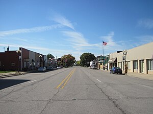
Iowa Highway 57
Iowa 57 highlighted in red | ||||
| Route information | ||||
| Maintained by Iowa DOT | ||||
| Length | 43.765 mi[1] (70.433 km) | |||
| Major junctions | ||||
| West end | ||||
| East end | ||||
| Location | ||||
| Country | United States | |||
| State | Iowa | |||
| Counties | ||||
| Highway system | ||||
| ||||
Iowa Highway 57 is a state highway that runs from west to east in northern Iowa. Its western terminus is at U.S. Route 65 northeast of Iowa Falls. Its eastern terminus is at an intersection with U.S. Highway 218, Iowa Highway 27, and Iowa Highway 58 in Cedar Falls. It currently follows much of U.S. Highway 20's old route from Cedar Falls to Iowa Falls.
Route description
Iowa Highway 57 begins at US 65 northeast of Iowa Falls and runs eastward along the Hardin County/Franklin County border. It goes through Ackley, then turns north shortly to go through Austinville. It turns eastward there and runs through Aplington before meeting Iowa 14 in Parkersburg. It continues east through New Hartford, then after a brief south turn, turns east to go through Cedar Falls. In the eastern part of Cedar Falls, near George Wyth Memorial State Park, Iowa Highway 57 ends when it meets US 218, Iowa 27, and Iowa 58.
History
At the time of designation, the highway went from Grundy Center northward to Cedar Falls. In August 1932, the segment from Grundy Center to Parkersburg was renumbered as Iowa 14. In 1986, when U.S. Highway 20 was expanded to four lanes to the Black Hawk/Grundy County line, Iowa 57 assumed 20's old route from Cedar Falls to Parkersburg. When the final four lane segment of U.S. 20 through the Iowa River Greenbelt opened on August 22, 2003, Iowa 57 was extended to cover the remainder of U.S. 20's old route to U.S. 65.
Major intersections
| County | Location | mi[1] | km | Destinations | Notes |
|---|---|---|---|---|---|
| Hardin–Franklin county line | Hardin–Grant township line | 0.000 | 0.000 | ||
| Butler | Parkersburg | 23.100 | 37.176 | Western end of Iowa 14 overlap | |
| 24.522 | 39.464 | Eastern end of Iowa 14 overlap | |||
| Grundy | No major intersections | ||||
| Black Hawk | Cedar Falls | 43.765 | 70.433 | ||
1.000 mi = 1.609 km; 1.000 km = 0.621 mi
| |||||
References
- ^ Jump up to: a b 2009 Volume of Traffic on the Primary Road System of Iowa (PDF) (Report). Iowa Department of Transportation. January 1, 2009. Retrieved January 15, 2011.
External links
- West end of Iowa 57 at Iowa Highway Ends
- East end of Iowa 57 at Iowa Highway Ends
