Voivodeship Road 430
(Redirected from Voivodeship road 430)
Jump to navigation
Jump to search
You can help expand this article with text translated from Voivodeship Road 430 in Polish. Click [show] for important translation instructions.
|
| Droga wojewódzka nr 430 (Polish) | ||||
 | ||||
| Route information | ||||
| Maintained by Wielkopolski Zarząd Dróg Wojewódzkich, Zarząd Dróg Miejskich w Poznaniu | ||||
| Length | 25 km (16 mi) | |||
| Major junctions | ||||
| From | Poznań | |||
| To | Mosina | |||
| Location | ||||
| Country | Poland | |||
| Regions | Greater Poland Voivodeship | |||
| Major cities | Poznań | |||
| Highway system | ||||
| ||||
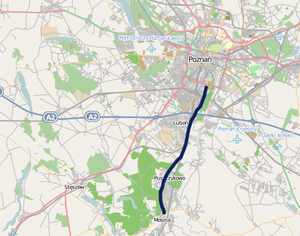
Voivodeship road 430 (Polish: Droga wojewódzka nr 430, abbreviated DW 430) is a route in the Polish voivodeship roads network. It runs through the Greater Poland Voivodeship (Poznań County), leading from Poznań, through Luboń and Puszczykowo to Mosina where it meets Voivodeship road 431.
Major cities and towns along the route
- Poznań (motorway A2, national road 5, national road 11, voivodeship road 196, Voivodeship road 433)
- Luboń
- Puszczykowo
- Mosina (Voivodeship road 431)
Route plan
This article contains a bulleted list or table of intersections which should be presented in a properly formatted junction table. |
| km | Icon | Name | Crossed roads |
|---|---|---|---|
| x | Mosina | Mocka Street | |
| x | Puszczykowo | Dworcowa Street | |
| x | Puszczykowo | Poznańska Street | |
| x | Łęczyca | Local road | |
| x | Luboń | Kręta Street | |
| x | Level crossing in Luboń, railway No. 271 Poznań — Wrocław | — | |
| x | Luboń | Powstańców Wielkopolskich Street | |
| x | Luboń | Dębiecka Street | |
| x | Poznań – Luboń interchange (formerly "Dębina") | ||
| x | Poznań | 28 czerwca 1956 Street | |
| x | Poznań – Filling station (Shell) | — | |
| x | Poznań | Czechosłowacka Street | |
| x | Short dual carriageway road stretch under railway bridge | — | |
| x | Poznań | Piastowska Street | |
| x | Poznań | Wspólna Street | |
| x | Poznań – Dolna Wilda interchange | ||
| x | |||
| x | |||
| x | |||
| x |